
Ground Penetrating Radar is utilized to detect the presence of buried utilities and various other structures such as underground storage tanks or culverts.
Ground Penetrating Radar (GPR)
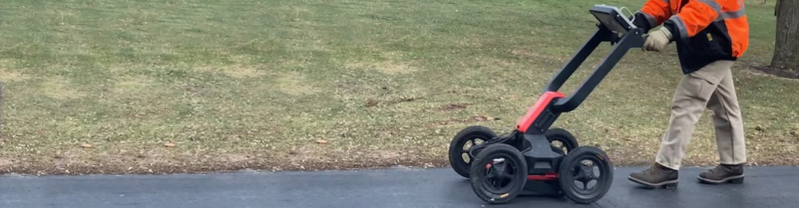
METI is capable of completing geophysical surveys utilizing a MALÅ Easy Locator Pro GPR unit with integrated GPS. Completing a GPR survey prior to intrusive site work such as soil borings or an excavation helps minimize the risk that subsurface structures will be encountered and conflict with site work. In turn, the risk of unexpected project cost increases and schedule changes due to damage to subsurface structures is reduced.
Our technicians have the ability to interpret GPR data in real-time and mark locations in the field. Using the integratred GPS unit we can also plot the location of marks on a site map for future reference or so that our clients can maintain marks during projects of extended duration. When further data interpretation is required, we utilize MALÅ Vision post-processing software to create, analyze, and interpret 2-D and 3-D radargrams. Each radargram can also be georeferenced to a specific site location when coupled with GPS data. This software is invaluable when interpreting nuances in data that simply cannot be completed in the field. The ability to present and visualize the data in 3-D provides an intuitive way to understand complex GPR data.
GPR compliments our drilling and contracting service offerings and helps our clients achieve their project goals. Where further investigation is necessary METI offers soft-dig and hand-clearing services to physically confirm utilities will not interfere with site work.